Staff Trail Pick: Mitch on East Boundary Ridge
- Posted on
- By Mitch & Nate Braks
- Posted in Staff Pick
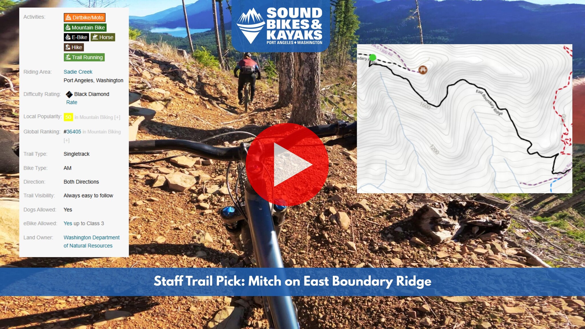
Brain-rattling singletrack meets world-class views on this moto-turned-MTB descent. It’s a lesser-known local black diamond that demands a brutal climb but pays out in spades. Follow along with Mitch’s POV video and discover why this should be your next weekend mission.
Sadie Creek Trail Spotlight: East Boundary Ridge
Intro
East Boundary Ridge is a hidden gem in the Sadie Creek network—a 1.4-mile black diamond singletrack located just outside of Port Angeles. Originally built for motos, this multi-directional trail is best experienced as a high-speed descent on a mountain bike.
While the trail is rugged, the line is always intuitive and easy to follow. Trailforks lists an average completion time of 8:30, but once you point the tires downhill, expect to reach the bottom in 6 to 8 minutes depending on how much you trust your brakes.
Fair warning: Reaching the ridge is a "pay-to-play" endeavor. It’s a stout climb regardless of your route, which makes it the perfect candidate for an e-MTB. In fact, if you have the option, we recommend leaving the analog bike at home and bringing the extra watt-hours. Whatever you ride, you’ll be rewarded with epic views of Lake Crescent and the valley below. Just make sure your technical skills are sharp; you'll be navigating moto ruts and baseball-sized "chatter" at high speeds.
Accessing East Boundary Ridge
You have two primary ways to reach the summit. Choose your own adventure based on how much you want to suffer for the day.
1. The Loop (For a Big Day Out)
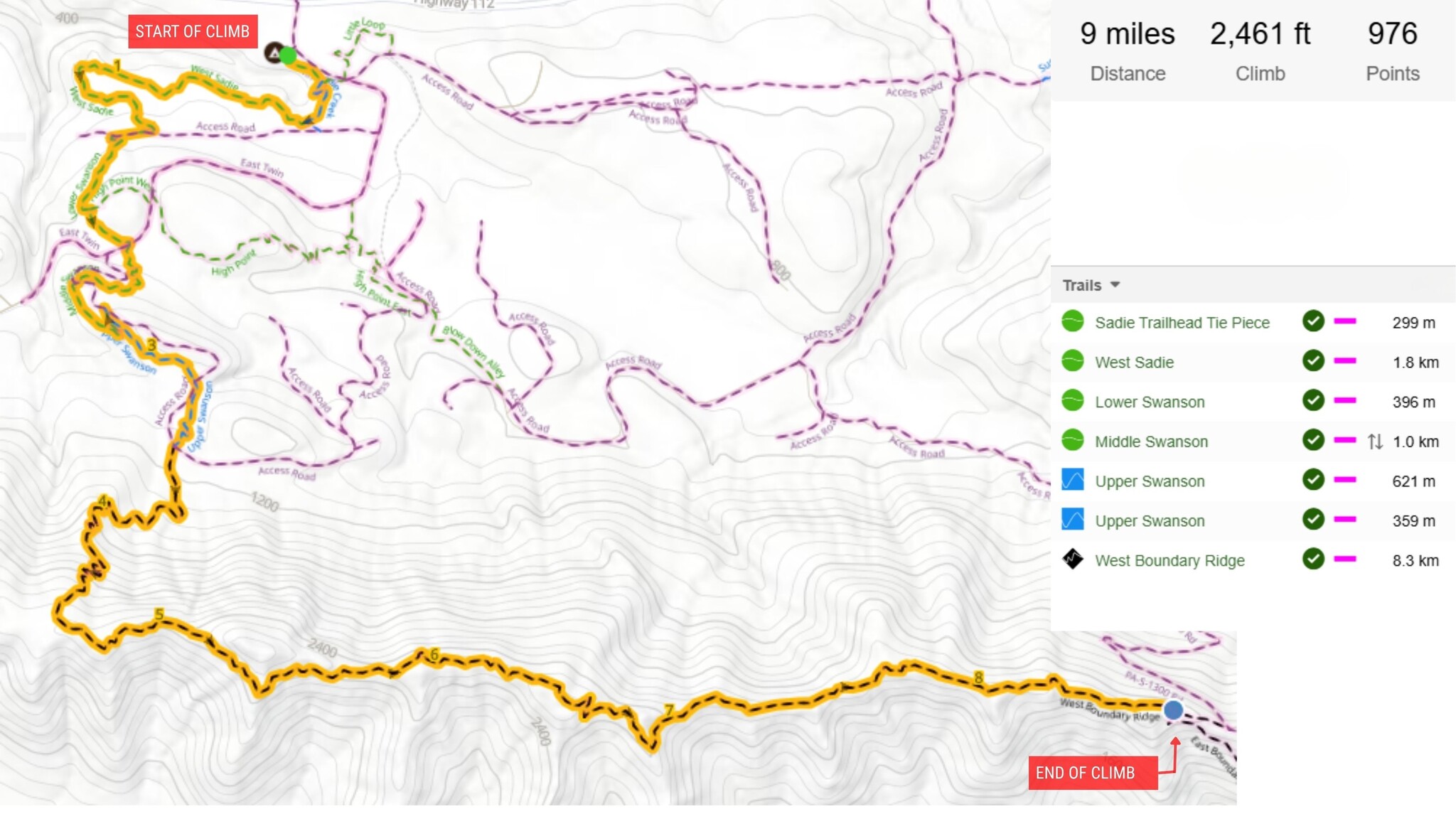
If you’re looking for a proper adventure, this is the one. This route utilizes a mix of moto and multi-use trails ranging from mellow green and blue double-track to the black diamond finish. We definitely recommend an e-bike for this route. If you’re going analog, bring plenty of fuel, fluids, and a high degree of fitness.
The Route: Sadie Creek Trailhead Tie Piece → Sadie Creek → West Sadie → Access road → Lower Swanson → Middle Swanson → Upper Swanson → West Boundary Ridge → East Boundary Ridge (Descent).
The Start: Park at the Sadie Creek Trailhead campground. Start on the Tie Piece trail and take an immediate right onto Sadie Creek. Take a right onto West Sadie. if you hit the access road, you’ve gone a little too far.
The Transition: After climbing West Sadie, merge onto the access road and cross the bridge. Look for the left turn onto Lower Swanson shortly after. From here, the route is straightforward as you work through the Swanson series to West Boundary Ridge.
Final Approach: West Boundary Ridge is the final, lengthy climb. It follows the ridgeline with spectacular views—a definite highlight before the payoff.
2. The Quickest Climb (Fire Road)
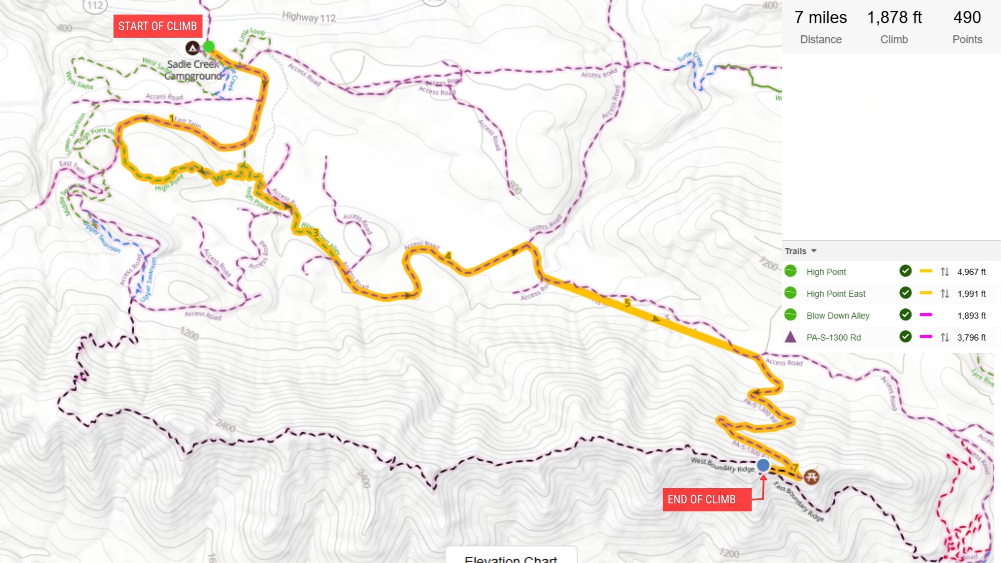
This is the "straight to business" route. It’s faster and more direct, though the fire road sections are steep and exposed.
The Route: East Twin River Road → Highpoint → Highpoint East → Blow Down Alley → PA S-1050 → Right on PA S-1000 → Right on PA S-1300 → East Boundary Ridge.
The Vibe: Expect a long, sustained grind. The road is well-maintained, but because much of it passes through clear-cuts, there is very little shade.
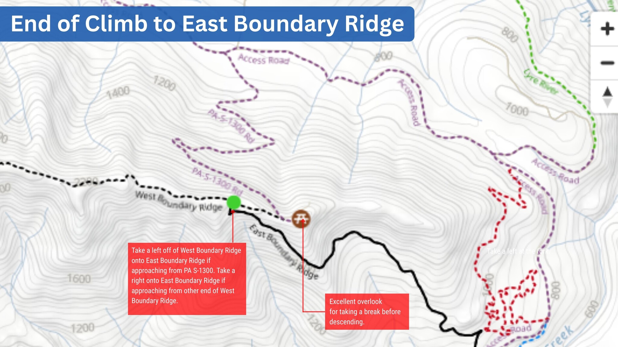
Final Approach: Near the top of PA S-1300, take the right fork to hit the end of West Boundary Ridge. The trailhead for East Boundary will be on your left almost immediately.
Pro Tip: If you want a break before the descent, take a left at the fork instead. Climb a little further to reach an amazing lookout point, then backtrack to East Boundary.
East Boundary Ridge Trail Breakdown
East Boundary Ridge is a raw, moto-oriented trail that rewards riders who love to let go of the brakes.
|
Feature
|
Description |
|
Difficulty:
|
Black Diamond |
|
Terrain:
|
Moto singletrack; a mix of bermed corners and flat turns with chunky surface conditions. |
|
Steepness:
|
Moderately steep. The challenge comes from the speed and the "loose and chunky" dirt rather than the gradient. |
|
Mandatory Features:
|
None. No mandatory drops or gaps. All airtime is optional, but watch for deep moto ruts. |
|
Style:
|
Fast, loose, and "organic." It feels like a real backcountry descent. |
|
Highlights:
|
Unbeatable views of Lake Crescent and 6–7 minutes of sustained, high-speed descending. |
The Ride
The Start: The trail kicks off in the trees with a sharp left-hand hairpin following a fast straightaway. From there, you’ll spend about a minute in the timber through a mix of supported and fast, sweeping turns.
The Middle: This is where the "brain-rattling" happens. The canopy opens up into a clear-cut, making the dirt looser and the views more expansive. You’ll navigate moto-grooves and baseball-sized rocks that require active suspension (and active focus!). Keep your heels down and look far ahead. You'll get some epic views of Lake Crescent here—just mind the exposure. Don’t get caught sightseeing and ride off the trail; it’s a long way down!
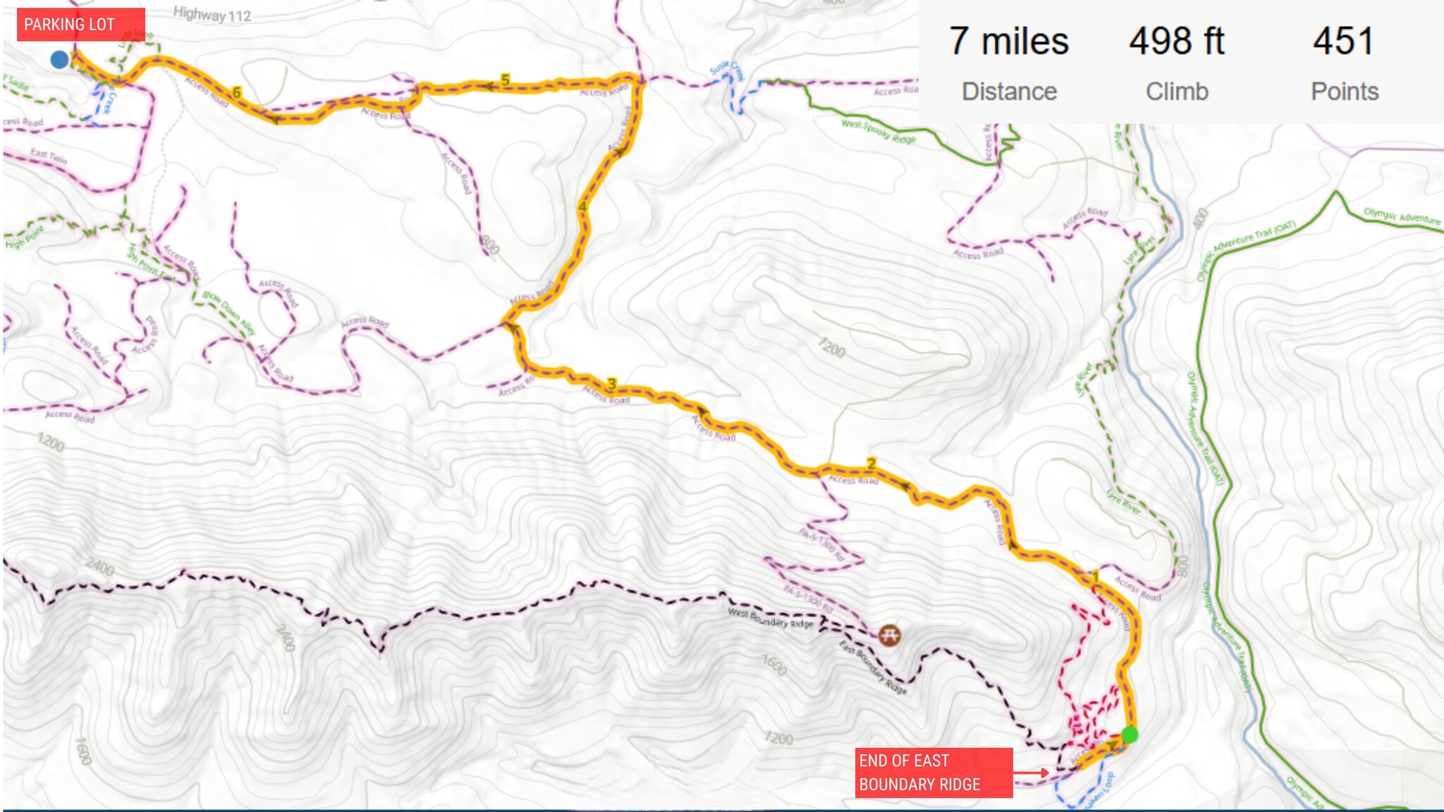
The Finish: You’ll hit another treed section about two minutes from the bottom. Line of sight decreases here, so keep your eyes and ears open for motos coming up the trail. Enjoy the shade, improved dirt quality, and some more bermed corners before the trail spits you out onto PA S-1000.
Getting Out
Once you finish the descent, take a left onto the service road. You have two ways back to the parking lot:
The Easy Way: Follow the service roads back to the staging area. This is the best choice if your legs are gassed.
The Bonus Lap: To squeeze in more trail time, take Lyre River → East Spooky Ridge → West Spooky Ridge → Susie Creek → Powerline Service Road. This route offers a mix of green and blue double-track descents to finish the day strong. Watch the videos below to get an idea of what this route is like.
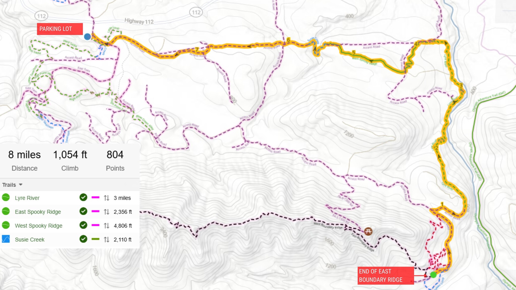
***Note: All of these trails are multi-directional and moto-primary. Please be respectful and keep an eye out for other trail users!
In Summary
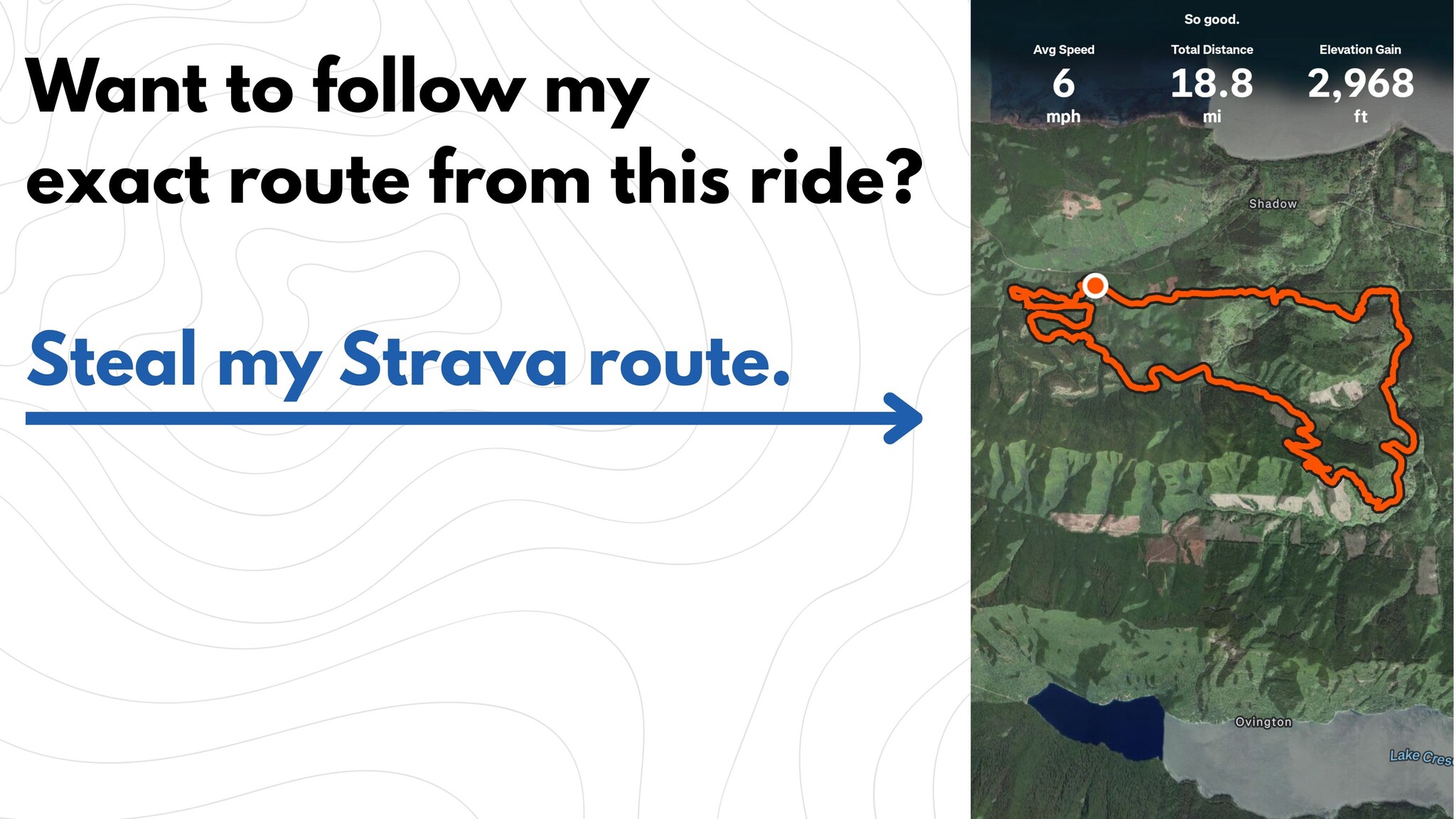
East Boundary Ridge is a fast, chunky, and wild ride. If you like getting fast and loose without needing gap jumps to have fun, you’ll love it here. Just be ready for the climb and maybe give your forearm muscles a pep-talk beforehand. If you would like to follow the exact route Mitch took on his ride, you can checkout this exact ride on Mitch's Strava.
What’s Next?
Want to check out more videos of mountain bike trails on the Olympic Peninsula? Check out our YouTube channel!

Gear Up: Thinking about an e-bike for a Sadie Creek mission? Or maybe you just need to restock on electrolytes and nutrition for a big "analog" day? Come see us at the shop and we'll get you dialed!
Thank you to the Washington State Department of Natural Resources & the crew from the NW Cup for maintaining this trail network.